
Valchiavenna
An extraordinary route, full of charm and fascination, offering multiple vantage points over the valley.
The natural setting is priceless. You move through an alpine habitat that has remained unchanged, in which signs of anthropization are almost absent.
Throughout the hike, you enjoy wonderful views that alone repay the many labors. The whole trail takes about 5 hours and is suitable for those with a good workout in their legs.
For those moving by car, arriving in Gordona it is necessary to take the consortium road to Val Bodengo.
Transit by cars is allowed with permission that can be acquired online https://www.valbodengo.shop/ or at the village bars.
After passing the Donadivo refreshment stand, continue to Pra Pincée (917 m) where the marked trail to Alpe Campo begins from a large parking area. The signage is well marked. The first section of the trail climbs gently through moist alder, willow, birch and maple forests. At the hairpin bend a marker post with trail signs provides directions to continue into the wild, secluded and surprising Garzelli Valley. The Fall of the Giants When you reach the clearing (1031 m), you bend and climb sharply to the left, passing under an imposing dark rock face known as the “Fall of the Giants.” Challenging climbing routes are present here. The trail begins to climb steeply again with narrow hairpin bends and, having passed a first small valley, enters a mainly fir forest where some specimens of silver fir (ambièz) are of considerable size. As you continue, the surrounding vegetation also changes, with larch trees and underbrush rich in rhododendrons and blueberries.
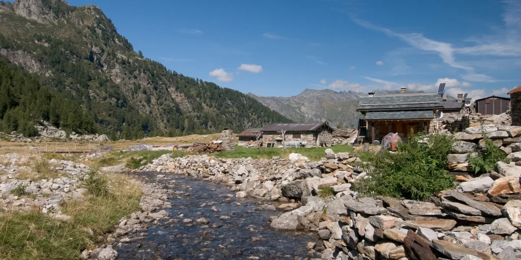
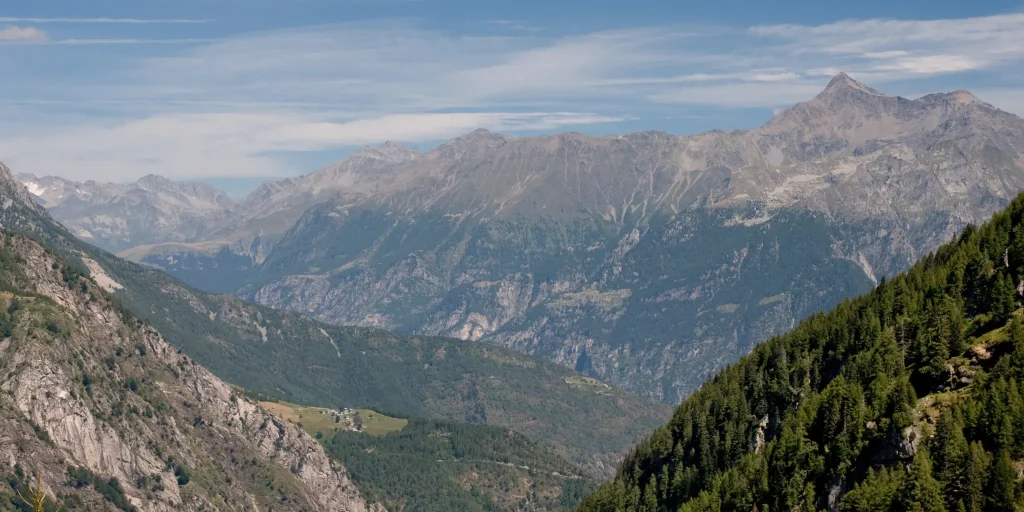
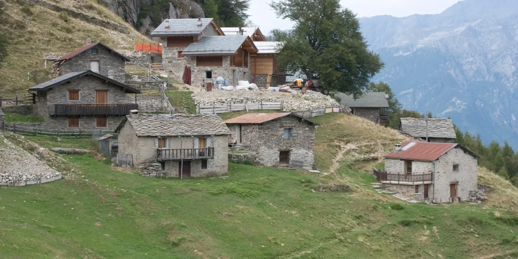
Once past the forest, Alpe Campo (1656 m) suddenly appears with its small huts, which gathered under rocks have almost all been renovated. Looking up, the mountains that frame the alp make it a picture of incomparable alpine charm. The jagged punta Anna Maria, the pizzi d’Alterno, pizzo Ledù, and monte Rabbi or Rotondo close the horizon to the south, while turning our gaze north we see the unmistakable pyramid of pizzo Stella with pizzo Emet and Suretta to its left.
From Alpe Campo we walk to the left and in an easterly direction we reach a plateau, where among sparse larches on a small log we find signposts indicating the direction to Alpe Borlasca, nearby painted on a boulder red-white arrows confirm the direction. We point north and the view opens up to a wide natural spectacle. To the south we can see the Avért di Campo also called Avérton, where at their apex is the wide Manduario saddle, a crossing point to Val Soe. The Manduario saddle is bordered toward Val Bodengo by the characteristic Monte Cucco. Below us dense mixed forests of beech, fir and birch cover the steep banks of the Val Garzelli. To the east we can see peeking out, behind the Codera – Masino rock walls, Mount Disgrazia almost always cloaked in snow.
The trail continues with several hairpin bends, and coming out of the woods the wide knoll with the meadows and huts of Bedolina (946 m) opens up. At the upper edge of this hill rises a small church with a large churchyard shaded by magnificent beech trees. The church is dedicated to Our Lady of Consolation and was blessed in 1764. It served the mountain people of Bedolina, Garzelli, Brusada, Prà Pincée and Barzena. On the facade of the church to the right of the portal, a plaque lists the names of workers who died in the construction of the tunnel to bring water to the Mese Hydroelectric Power Plant (1940-1945). As many as 19 of them perished buried by an avalanche in the Garzelli Valley on April 5, 1941. Leaving the little church behind, we walk along the car road to the junction, where the track to Mount Garzelli begins, which we follow to a marker post and walk on a level path back to the footbridge over the Boggia and to the parking lot of the beautiful group of houses at Pra Pincèe.
Difficulty: Hard
Duration: 4:45 h
Distance: 10,03 km
Ascent: 894 mt
Descent: 895 mt
Highest point: 1779 mt
Lowest point: 895 mt
Best time of year:
Public transport: It is possible to reach Gordona by bus connection STPS line.
For schedules https://www.stps.it/
Starting point: get directions in Google Maps
Piazza Caduti per la Libertà, 4
23022 Chiavenna (SO)
0343 37485
consorzioturistico@valchiavenna.com
Valchiavenna
Related experiences
From Donadivo to Lavorerio Alp
From Gordona, more trained hikers can already start walking to the alp. Alternatively, one can drive to the village of Donadivo (737 m). From here on foot in three hours you will reach your destination. A third opportunity is provided by the Orlo alp (1165 m) reachable by car, gaining about an hour’s walk, at […]

Hike Voga – Alpe Buglio – Forcola Bivouac
The route starts from the hamlet Voga of Menarola and climbs steeply passing through Alpe Dardano (1334 m a.s.l.) and then Alpe Buglio (1554 m a.s.l.). From Alpe Buglio the path continues to the left keeping on the slope; it continues with a slight incline crossing a sparse larch forest. A deviation to the left […]

Donadivo – Cermine – Alpe Cima hike
Every mule track is a masterpiece of ingenuity and taste. The long mule track that climbs from Gordona to the Alpe Cermine is among the most beautiful in Valchiavenna. It is the so-called benefactor’s mule track. The view that will open before your eyes during the route, as well as the one you will appreciate […]

Bodengo – Corte Terza – Bivacco Alpe Notaro Hiking
By following this route you have the opportunity to discover the ancient paths used by the “spalloni”, the smugglers who from long ago transported goods between Switzerland and Italy. Start by car from Gordona. From here, take the road that climbs towards Val Bodengo (you need to get a pass, purchasable at the start of […]

Excursion to Rifugio Il Biondo
The commitment of the CAI members, with the support of the Prata Camportaccio Forest Consortium, gave life to a welcoming and well-organized building, to which many have attached affection and personal memories. For those wanting to reach this destination, there are two very beautiful routes that develop on the two sides of Val Schiesone. From […]

Hotel
Comfortable stays in the heart of Valchiavenna, combining hospitality, services and Alpine landscapes to experience in every season.

Bed & breakfast
Small properties and welcoming atmospheres to experience Valchiavenna simply, with authentic hospitality and a strong connection to the local area.

Holiday homes
Independent accommodation solutions to feel at home even on holiday and discover Valchiavenna at your own pace.

Mountain huts and campsites
Hospitality immersed in nature, among local traditions, mountain life and the pleasure of experiencing the area more closely.